NASA satellites discover methane ‘hot spot’ over the U.S is bigger than expected

(The Four Corners area (red) is the major U.S. hot spot for methane emissions – Photo Credit: NASA/JPL-Caltech/University of Michigan)

Satellite data, studied by scientists at NASA and the University of Michigan, has revealed that one small “hot spot” is responsible for producing the largest concentration of greenhouse gas methane seen over the United States – more than triple the standard ground-based estimate. The hot spot, near the Four Corners intersection of Arizona, Colorado, New Mexico and Utah, covers about 2,500 square miles (6,500 square kilometers). It is about half the size of Connecticut.
Continue reading

Image of the Day: 29/9/14

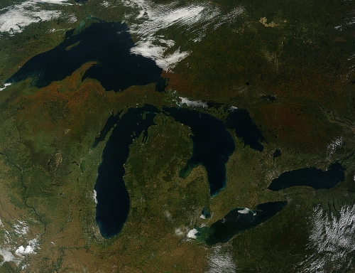
(Photo Credit: Jeff Schmaltz/NASA GSFC)

A few days after the calendar officially announced that autumn had arrived in the Northern Hemisphere, the Moderate Resolution Imagingi Spectroradiometer (MODIS) on NASA’s Terra satellite captured this view of fall colours around the Great Lakes as the season made a visible impact on the North American landscape. Continue reading

Lockheed Martin to begin tracking potentially dangerous space debris

(The current number of space debris objects in orbit – Photo Credit: ESA)

Lockheed Martin, an aerospace and defence giant, has struck a deal with an Australian technology firm to track space debris that could pose a threat to orbiting satellites. Continue reading

NASA’s OCO-2 satellite lifts off to begin carbon-counting mission

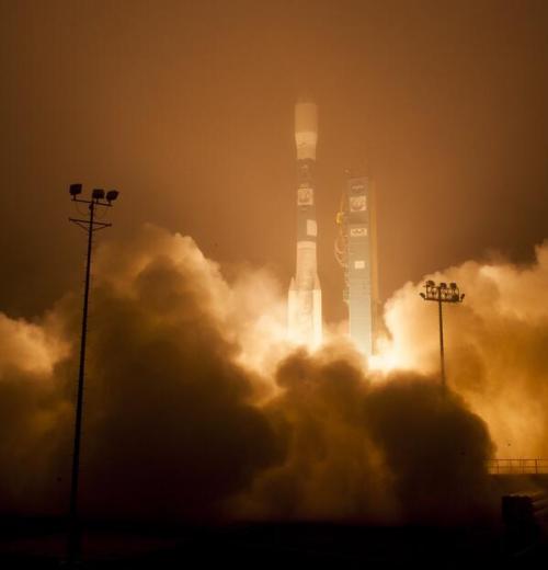
(Photo Credit:NASA/Bill Ingalls)

Following delays, NASA’s OCO-2 mission has now successfully blasted off aboard an United Launch Alliance Delta II rocket. Launched from Vandenberg Air Force Base in California early on Wednesday morning, OCO-2 will begin a landmark mission to survey carbon dioxide gas in Earth’s atmosphere once it arrives in orbit.